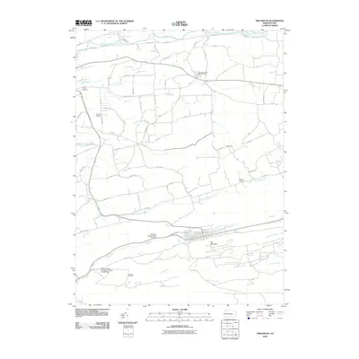
2010 Map of Trevorton
USGS Topo · Published 2010About this map
Big Mountain anchors the southern portion of this landscape, its steep slopes marking a sharp divide from the coal-processing and transit hubs concentrated in the valley below. Industrial heritage is central here, with the Sunshine Coal Company Number Sixteen Dam and Trevorton Plant Number One Dam positioned along Zerbe Run, illustrating the managed water systems necessary for anthracite operations. The grid-patterned settlement of Trevorton serves as the primary residential hub, while smaller crossroads like Farnsworth and localized landmarks such as the Trevorton Fire Tower dot the more rural tracts to the north.
Find a feature on this map
72 named features on this map. Tap any name to fly to it.
Don’t see what you’re looking for? This feature index may not catch every label — zoom into the map to look around manually.
Map Details
Editions of this 2010 Trevorton Map
This is the sole edition of this map. No revisions or reprints were ever made.
Other maps of this area

1892 · Lykens
USGS Topo · 1:62,500

1892 · Shamokin
USGS Topo · 1:62,500

1893 · Sunbury
USGS Topo · 1:62,500

1893 · Lykens
USGS Topo · 1:62,500

1893 · Shamokin
USGS Topo · 1:62,500

1893 · Millersburg
USGS Topo · 1:62,500

1943 · Millersburg
USGS Topo · 1:62,500

1943 · Lykens
USGS Topo · 1:62,500

1943 · Shamokin
USGS Topo · 1:62,500

1943 · Sunbury
USGS Topo · 1:62,500
Featured Places
- West Cameron Township, PA
- Rockefeller Township, PA
- Augustaville, Rockefeller Township
- Farnsworth, Shamokin Township
- Little Mahanoy Township, PA