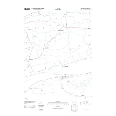
2013 Map of Trevorton
USGS Topo · Published 2013About this map
Trevorton anchors the southern portion of this Northumberland County landscape, situated along the corridor of Zerbe Run at the base of Big Mountain. The settlement pattern reflects a network of rural crossroads and small communities, including Stonington, Augustaville, and Seven Points, connected by a complex web of local routes like Captain Bloom Rd and Anthracite Rd. The northern drainage is defined by Shamokin Cr and Plum Cr, while the central area shows the winding course of Little Shamokin Cr. Historical markers of the region's utility and topography are evident in features such as the Trevorton Fire Tower and family-named locales like Dunkelbergers and Millers Crossroads. The map captures the transitional character between the mountainous coal-country terrain to the south and the more dispersed agricultural valley settlements to the north.
Find a feature on this map
89 named features on this map. Tap any name to fly to it.
Don’t see what you’re looking for? This feature index may not catch every label — zoom into the map to look around manually.
Map Details
Editions of this 2013 Trevorton Map
This is the sole edition of this map. No revisions or reprints were ever made.
Other maps of this area

1892 · Lykens
USGS Topo · 1:62,500

1892 · Shamokin
USGS Topo · 1:62,500

1893 · Sunbury
USGS Topo · 1:62,500

1893 · Lykens
USGS Topo · 1:62,500

1893 · Shamokin
USGS Topo · 1:62,500

1893 · Millersburg
USGS Topo · 1:62,500

1943 · Millersburg
USGS Topo · 1:62,500

1943 · Lykens
USGS Topo · 1:62,500

1943 · Shamokin
USGS Topo · 1:62,500

1943 · Sunbury
USGS Topo · 1:62,500
Featured Places
- West Cameron Township, PA
- Rockefeller Township, PA
- Augustaville, Rockefeller Township
- Farnsworth, Shamokin Township
- Little Mahanoy Township, PA