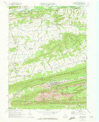
1969 Map of Trevorton
USGS Topo · Published 1972About this map
Trevorton sits at the base of Big Mountain, anchoring a landscape defined by the anthracite industry and the ridges of central Pennsylvania. The southern half of the map reveals the heavy footprint of coal extraction, with extensive Strip Mines, Mine Dumps, and Tailings Ponds flanking the Reading railroad corridor. This industrial density contrasts sharply with the agricultural character of Rockefeller and Upper Augusta to the north, where small rural hubs like Augustaville and Seven Points are connected by winding valley roads.
Find a feature on this map
56 named features on this map. Tap any name to fly to it.
Don’t see what you’re looking for? This feature index may not catch every label — zoom into the map to look around manually.
Map Details
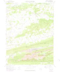
Editions of this 1969 Trevorton Map
2 editions found
Other maps of this area

1892 · Lykens
USGS Topo · 1:62,500

1892 · Shamokin
USGS Topo · 1:62,500

1893 · Sunbury
USGS Topo · 1:62,500

1893 · Lykens
USGS Topo · 1:62,500

1893 · Shamokin
USGS Topo · 1:62,500

1893 · Millersburg
USGS Topo · 1:62,500

1943 · Millersburg
USGS Topo · 1:62,500

1943 · Lykens
USGS Topo · 1:62,500

1943 · Shamokin
USGS Topo · 1:62,500

1943 · Sunbury
USGS Topo · 1:62,500
Featured Places
- West Cameron Township, PA
- Zerbe Township, PA
- Rockefeller Township, PA
- Upper Augusta Township, PA
- Shamokin Township, PA