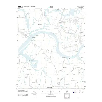
2011 Map of Triana
USGS Topo · Published 2011About this map
The Tennessee River and the massive expanse of Wheeler Lake dominate this portion of the Tennessee Valley, shaping the settlement patterns and transport corridors south of Huntsville. The historic river town of Triana sits at the confluence with Indian Creek, served by facilities like Triana Landing and Sunnyside Landing. The landscape is a mix of protected government land at the Redstone Arsenal and rural farmsteads further south.
Find a feature on this map
130 named features on this map. Tap any name to fly to it.
Don’t see what you’re looking for? This feature index may not catch every label — zoom into the map to look around manually.
Map Details
Editions of this 2011 Triana Map
This is the sole edition of this map. No revisions or reprints were ever made.
Other maps of this area

1888 · Cullman
USGS Topo · 1:125,000

1888 · Huntsville
USGS Topo · 1:125,000

1892 · Cullman
USGS Topo · 1:125,000

1892 · Huntsville
USGS Topo · 1:125,000

1936 · Triana
USGS Topo · 1:24,000

1936 · Madison
USGS Topo · 1:24,000

1936 · Somerville
USGS Topo · 1:24,000

1936 · Center Grove
USGS Topo · 1:24,000

1936 · Mason Ridge
USGS Topo · 1:24,000

1936 · Greenbrier
USGS Topo · 1:24,000