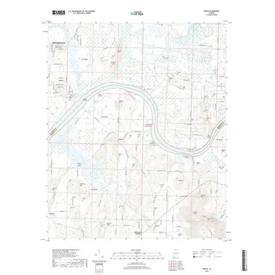
2018 Map of Triana
USGS Topo · Published 2018About this map
Wheeler Lake defines the central geography of this region, where the Tennessee River winds past the Madison and Morgan County line. The settlement of Triana sits at a prominent bend, surrounded by a high density of family burial grounds and historical sites including the Triana Cem and Batts-Ward Cem. The landscape transitions from the river bottoms of Moon Bottom and Talley Bottom to the rising elevations of Hatton Mtn and Bradford Mtn in the north. To the south, the terrain becomes more complex near Valhermoso Springs, characterized by numerous natural features like Cove Spring and Bowers Spring. This area is a rich resource for genealogists, documenting numerous small cemeteries such as Horton-Joiner Cem and Penland-Cooper Cem alongside local landmarks like Sharps Ford Bridge and the uniquely named The Booger Hole.
Find a feature on this map
140 named features on this map. Tap any name to fly to it.
Don’t see what you’re looking for? This feature index may not catch every label — zoom into the map to look around manually.
Map Details
Editions of this 2018 Triana Map
This is the sole edition of this map. No revisions or reprints were ever made.
Other maps of this area

1888 · Cullman
USGS Topo · 1:125,000

1888 · Huntsville
USGS Topo · 1:125,000

1892 · Cullman
USGS Topo · 1:125,000

1892 · Huntsville
USGS Topo · 1:125,000

1936 · Triana
USGS Topo · 1:24,000

1936 · Madison
USGS Topo · 1:24,000

1936 · Somerville
USGS Topo · 1:24,000

1936 · Center Grove
USGS Topo · 1:24,000

1936 · Mason Ridge
USGS Topo · 1:24,000

1936 · Greenbrier
USGS Topo · 1:24,000