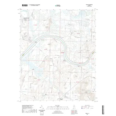
2020 Map of Triana
USGS Topo · Published 2020About this map
Triana and Valhermoso Springs occupy the northern and southern banks of the Tennessee River as it snakes between Madison and Morgan counties. The landscape is defined by the sharp transition from the river bottomlands of Moon Bottom and Talley Bottom to the rising elevations of Barkley Mtn and Breeding Mtn. This modern survey reveals a dense concentration of family and community burial sites, including the Batts-Ward Cem and New Triana Cem, which speak to the deep-rooted settlement patterns of the region.
Find a feature on this map
142 named features on this map. Tap any name to fly to it.
Don’t see what you’re looking for? This feature index may not catch every label — zoom into the map to look around manually.
Map Details
Editions of this 2020 Triana Map
This is the sole edition of this map. No revisions or reprints were ever made.
Other maps of this area

1888 · Cullman
USGS Topo · 1:125,000

1888 · Huntsville
USGS Topo · 1:125,000

1892 · Cullman
USGS Topo · 1:125,000

1892 · Huntsville
USGS Topo · 1:125,000

1936 · Triana
USGS Topo · 1:24,000

1936 · Madison
USGS Topo · 1:24,000

1936 · Somerville
USGS Topo · 1:24,000

1936 · Center Grove
USGS Topo · 1:24,000

1936 · Mason Ridge
USGS Topo · 1:24,000

1936 · Greenbrier
USGS Topo · 1:24,000