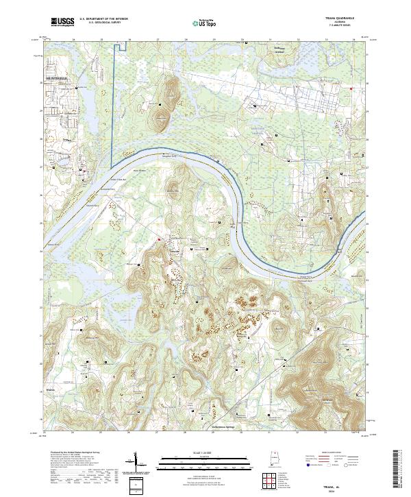
2024 Map of Triana
USGS Topo · Published 2024About this map
The Tennessee River defines the heart of this landscape, winding between Madison and Morgan counties in a stretch marked by historic river crossings and alluvial bottoms. The northern bank is home to Triana, where the Wheeler National Wildlife Refuge and the military grounds of Redstone Arsenal meet. This area shows a complex network of backwaters and sloughs like Crowder Slough and Swan Pond. South of the river, the terrain rises into prominent elevations such as Barkley Mtn and Walling Mtn.
Find a feature on this map
153 named features on this map. Tap any name to fly to it.
Don’t see what you’re looking for? This feature index may not catch every label — zoom into the map to look around manually.
Map Details
Editions of this 2024 Triana Map
This is the sole edition of this map. No revisions or reprints were ever made.
Other maps of this area

1888 · Cullman
USGS Topo · 1:125,000

1888 · Huntsville
USGS Topo · 1:125,000

1892 · Cullman
USGS Topo · 1:125,000

1892 · Huntsville
USGS Topo · 1:125,000

1936 · Triana
USGS Topo · 1:24,000

1936 · Madison
USGS Topo · 1:24,000

1936 · Somerville
USGS Topo · 1:24,000

1936 · Center Grove
USGS Topo · 1:24,000

1936 · Mason Ridge
USGS Topo · 1:24,000

1936 · Greenbrier
USGS Topo · 1:24,000