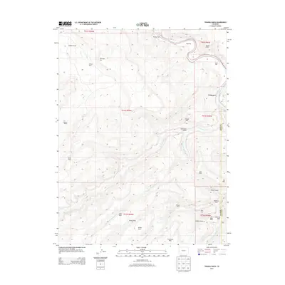
2013 Map of Triangle Mesa
USGS Topo · Published 2013About this map
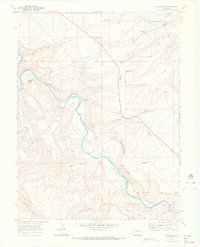
The Gunnison River carves through the eastern portion of this landscape, providing a vital water source for the settlement of Bridgeport. The terrain is characterized by a series of prominent elevated formations and deep drainage systems, including the namesake Triangle Mesa and the expansive Dominguez Canyon. To the west, the land rises into Cactus Park and Horse Mesa, while various watercourses like Big Dominguez Cr and Dry Fork Big Dominguez Cr dictate the local topography. This 2013 survey reveals an intricate network of named draws and canyons such as Wildhorse Draw and Poison Canyon, alongside high-elevation features like Steamboat Mesa and Long Mesa. The presence of Warm Spring suggests localized geothermal activity amidst the mesas and flats that define this part of the Mesa and Delta County border region.
Find a feature on this map
35 named features on this map. Tap any name to fly to it.
Don’t see what you’re looking for? This feature index may not catch every label — zoom into the map to look around manually.
Map Details
Editions of this 2013 Triangle Mesa Map
This is the sole edition of this map. No revisions or reprints were ever made.
Other maps of this area

1956 · Moab
USGS Topo · 1:250,000

1959 · Moab
USGS Topo · 1:250,000

1960 · Moab
USGS Topo · 1:250,000

1962 · Moab
USGS Topo · 1:250,000

1964 · Moab
USGS Topo · 1:250,000

1965 · Moab
USGS Topo · 1:250,000
1969 · Whitewater
USGS Topo · 1:24,000
1969 · Juniata Reservoir
USGS Topo · 1:24,000
1969 · Triangle Mesa
USGS Topo · 1:24,000
1969 · Dominguez
USGS Topo · 1:24,000