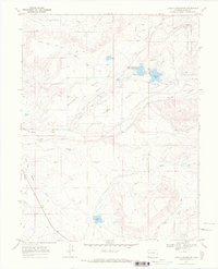
1969 Map of Juniata Reservoir
USGS Topo · Published 1972About this map
Purdy Mesa and the surrounding high desert terrain in Mesa County are defined by a complex network of water management features designed to sustain ranching and agriculture in this arid landscape. This late 1960s environment shows a sophisticated system of reservoirs and aqueducts, including the Reeder Mesa Flow Line and the Kannah Creek Flow Line. Significant water storage is provided by Juniata Res and Hallenbeck Reservoir, which serve as vital hubs for local irrigation via the Juniata Ditch and Lander Extension Ditch.
Find a feature on this map
31 named features on this map. Tap any name to fly to it.
Don’t see what you’re looking for? This feature index may not catch every label — zoom into the map to look around manually.
Map Details
Editions of this 1969 Juniata Reservoir Map
3 editions found
Other maps of this area

1956 · Moab
USGS Topo · 1:250,000

1956 · Grand Junction
USGS Topo · 1:250,000

1959 · Grand Junction
USGS Topo · 1:250,000

1959 · Moab
USGS Topo · 1:250,000

1960 · Moab
USGS Topo · 1:250,000

1960 · Grand Junction
USGS Topo · 1:250,000

1962 · Moab
USGS Topo · 1:250,000

1962 · Grand Junction
USGS Topo · 1:250,000

1962 · Clifton
USGS Topo · 1:24,000
1962 · Lands End
USGS Topo · 1:24,000