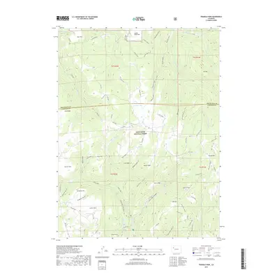
2019 Map of Triangle Park
USGS Topo · Published 2019About this map
White River National Forest defines this high-elevation landscape on the border of Rio Blanco and Garfield counties. The topography is dominated by the massive Coulter Mesa and significant peaks such as Snowdrift Mtn and Mid Mtn. A network of drainage systems, including Whiskey Gulch, Prospect Draw, and Trappers Gulch, carves the terrain between prominent ridges like Banner Ridge and Irish Ridge.
Find a feature on this map
76 named features on this map. Tap any name to fly to it.
Don’t see what you’re looking for? This feature index may not catch every label — zoom into the map to look around manually.
Map Details
Editions of this 2019 Triangle Park Map
This is the sole edition of this map. No revisions or reprints were ever made.
Other maps of this area

1906 · Grand Hogback
USGS Topo · 1:125,000

1910 · Grand Hogback
USGS Topo · 1:125,000

1952 · Horse Mountain
USGS Topo · 1:24,000

1957 · Leadville
USGS Topo · 1:250,000

1959 · Leadville
USGS Topo · 1:250,000

1960 · Leadville
USGS Topo · 1:250,000

1962 · Leadville
USGS Topo · 1:250,000

1964 · Leadville
USGS Topo · 1:250,000
1966 · Rifle Falls
USGS Topo · 1:24,000
1966 · Meadow Creek Lake
USGS Topo · 1:24,000