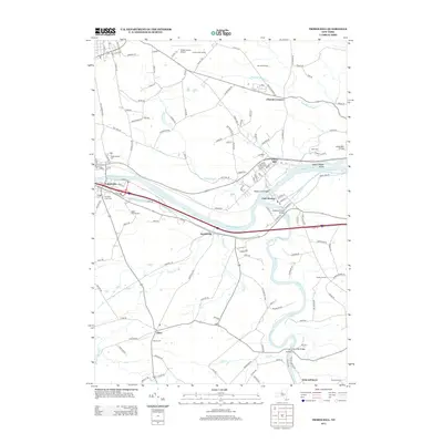
2013 Map of Tribes Hill
USGS Topo · Published 2013About this map
The Mohawk River corridor serves as the primary artery for transport and settlement in this section of New York, where the CSX rail line and Interstate 90 parallel the water. Historically significant communities like Fultonville and Fort Hunter anchor the valley, while the village of Tribes Hill overlooks Upper Pepper Island from the northern bank. The convergence of the Schoharie Cr and the Mohawk is a focal point of civil engineering, marked by the Barge Canal Bridge and Schoharie Creek Bridge.
Find a feature on this map
139 named features on this map. Tap any name to fly to it.
Don’t see what you’re looking for? This feature index may not catch every label — zoom into the map to look around manually.
Map Details
Editions of this 2013 Tribes Hill Map
This is the sole edition of this map. No revisions or reprints were ever made.
Other maps of this area

1895 · Amsterdam
USGS Topo · 1:62,500

1896 · Fonda
USGS Topo · 1:62,500

1898 · Fonda
USGS Topo · 1:62,500

1899 · Broadalbin
USGS Topo · 1:62,500

1902 · Broadalbin
USGS Topo · 1:62,500

1902 · Fonda
USGS Topo · 1:62,500

1903 · Gloversville
USGS Topo · 1:62,500

1931 · Amsterdam
USGS Topo · 1:62,500

1943 · Gloversville
USGS Topo · 1:62,500
1943 · Carlisle
USGS Topo · 1:24,000