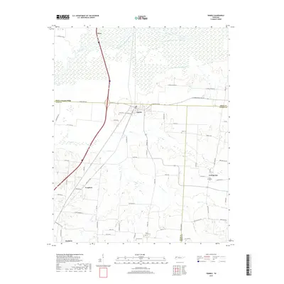
2019 Map of Trimble
USGS Topo · Published 2019About this map
Obion and Trimble sit at the northern edge of this West Tennessee landscape, where the managed waters of the Obion River and the Old Obion River Drainage Canal dominate the low-lying terrain. The map documents a predominantly rural and agricultural environment punctuated by small settlements and family landmarks. Road networks like Sharpes Ferry Rd and Mason Hall Rd connect the dispersed communities of Templeton and Cool Springs. For those researching local heritage, the map identifies several significant burial sites, including Pierce Cem near Trimble and the McCorkle Cem further south. The southern boundary of the sheet reaches the outskirts of Newbern, illustrating the transition from the river bottomlands to the more elevated agricultural fields of Dyer and Gibson Counties.
Find a feature on this map
67 named features on this map. Tap any name to fly to it.
Don’t see what you’re looking for? This feature index may not catch every label — zoom into the map to look around manually.
Map Details
Editions of this 2019 Trimble Map
This is the sole edition of this map. No revisions or reprints were ever made.
Other maps of this area

1925 · Reelfoot Lake
USGS Topo · 1:62,500

1939 · Reelfoot Lake
USGS Topo · 1:62,500

1939 · Dyersburg
USGS Topo · 1:62,500

1950 · Obion
USGS Topo · 1:24,000

1950 · Rives
USGS Topo · 1:24,000

1951 · Obion
USGS Topo · 1:24,000

1951 · Rives
USGS Topo · 1:24,000

1952 · Newbern
USGS Topo · 1:24,000

1952 · Lane
USGS Topo · 1:24,000

1956 · Reelfoot Lake
USGS Topo · 1:62,500