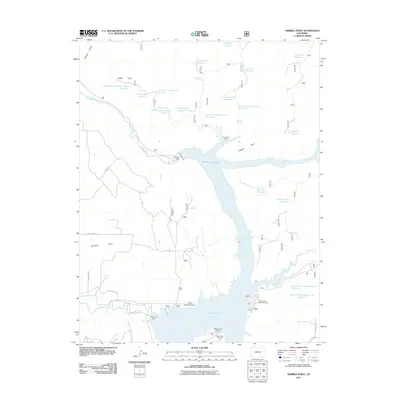
2011 Map of Trimble Point
USGS Topo · Published 2011About this map
McPhee Reservoir dominates this landscape in Montezuma County, illustrating the extensive water management infrastructure of the Four Corners region. Formed by the McPhee Dam and reinforced by the Great Cut Dike, the reservoir provides a massive catchment for the Dolores River and feeds an intricate network of irrigation systems including the Dove Creek Canal, Moonlight Lateral, and Lone Pine Lateral.
Find a feature on this map
44 named features on this map. Tap any name to fly to it.
Don’t see what you’re looking for? This feature index may not catch every label — zoom into the map to look around manually.
Map Details
Editions of this 2011 Trimble Point Map
This is the sole edition of this map. No revisions or reprints were ever made.
Other maps of this area

1956 · Cortez
USGS Topo · 1:250,000

1958 · Cortez
USGS Topo · 1:250,000

1959 · Cortez
USGS Topo · 1:250,000

1962 · Cortez
USGS Topo · 1:250,000

1965 · Willow Spring
USGS Topo · 1:24,000

1965 · Dolores East
USGS Topo · 1:24,000

1965 · Dolores West
USGS Topo · 1:24,000

1965 · Yellow Jacket
USGS Topo · 1:24,000
1965 · Arriola
USGS Topo · 1:24,000
1965 · Boggy Draw
USGS Topo · 1:24,000