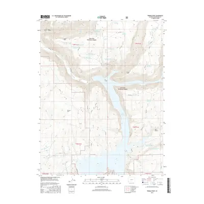
2016 Map of Trimble Point
USGS Topo · Published 2016About this map
McPhee Reservoir dominates the eastern half of this landscape, its fingers reaching into the canyons and draws of the San Juan National Forest. To the west, the Dolores River winds through the high country toward the prominent lookout of Trimble Point. This 2016 survey illustrates a complex water management system essential to the arid high plateau, featuring a dense network of upland catchments such as Gardner Reservoir, Dunham Reservoir, and several basins named for Hoppe Point. The southern portion of the map reveals the infrastructure of regional agriculture, defined by the Dove Creek Canal and distribution ditches like the Moonlight Lateral and U Lateral. These man-made watercourses contrast with the natural drainage patterns of Salter Canyon and Dry Canyon, showing how modern irrigation has adapted to the challenging terrain of Montezuma County.
Find a feature on this map
49 named features on this map. Tap any name to fly to it.
Don’t see what you’re looking for? This feature index may not catch every label — zoom into the map to look around manually.
Map Details
Editions of this 2016 Trimble Point Map
This is the sole edition of this map. No revisions or reprints were ever made.
Other maps of this area

1956 · Cortez
USGS Topo · 1:250,000

1958 · Cortez
USGS Topo · 1:250,000

1959 · Cortez
USGS Topo · 1:250,000

1962 · Cortez
USGS Topo · 1:250,000

1965 · Willow Spring
USGS Topo · 1:24,000

1965 · Dolores East
USGS Topo · 1:24,000

1965 · Dolores West
USGS Topo · 1:24,000

1965 · Yellow Jacket
USGS Topo · 1:24,000
1965 · Arriola
USGS Topo · 1:24,000
1965 · Boggy Draw
USGS Topo · 1:24,000