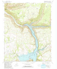
1993 Map of Trimble Point
USGS Topo · Published 1993About this map
McPhee Reservoir dominates this landscape, having transformed the Dolores River valley into a center for water management and recreation within the San Juan National Forest. The engineering of the late 20th century is evident through McPhee Dam, the Dove Creek Canal, and the Great Cut Dike, which redirect water across the high plateau.
Find a feature on this map
46 named features on this map. Tap any name to fly to it.
Don’t see what you’re looking for? This feature index may not catch every label — zoom into the map to look around manually.
Map Details
Editions of this 1993 Trimble Point Map
This is the sole edition of this map. No revisions or reprints were ever made.
Other maps of this area

1956 · Cortez
USGS Topo · 1:250,000

1958 · Cortez
USGS Topo · 1:250,000

1959 · Cortez
USGS Topo · 1:250,000

1962 · Cortez
USGS Topo · 1:250,000

1965 · Willow Spring
USGS Topo · 1:24,000

1965 · Dolores East
USGS Topo · 1:24,000

1965 · Dolores West
USGS Topo · 1:24,000

1965 · Yellow Jacket
USGS Topo · 1:24,000
1965 · Arriola
USGS Topo · 1:24,000
1965 · Boggy Draw
USGS Topo · 1:24,000