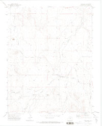
1971 Map of Trinchera
USGS Topo · Published 1973About this map
Trinchera and Trinchera Plaza serve as the primary focal points of this southern Colorado landscape during the early 1970s. The area is defined by a sophisticated network of irrigation systems, including the Newcomb Ditch, Border Ditch, Hart Ditch, and Trinchera Ditch, which redirect water from Trinchera Creek and Rito Azul to support local agricultural efforts. These man-made watercourses follow the natural contours of the land, navigating around prominent landmarks like Nola Butte and Plaza Butte.
Find a feature on this map
24 named features on this map. Tap any name to fly to it.
Don’t see what you’re looking for? This feature index may not catch every label — zoom into the map to look around manually.
Map Details
Editions of this 1971 Trinchera Map
This is the sole edition of this map. No revisions or reprints were ever made.
Other maps of this area

1891 · Mesa De Maya
USGS Topo · 1:125,000

1892 · Elmoro
USGS Topo · 1:125,000

1893 · Elmoro
USGS Topo · 1:125,000

1893 · Mesa de Maya
USGS Topo · 1:125,000

1897 · Elmoro
USGS Topo · 1:125,000

1954 · Raton
USGS Topo · 1:250,000

1954 · Trinidad
USGS Topo · 1:250,000

1954 · Dalhart
USGS Topo · 1:250,000

1955 · La Junta
USGS Topo · 1:250,000

1955 · Trinidad
USGS Topo · 1:250,000