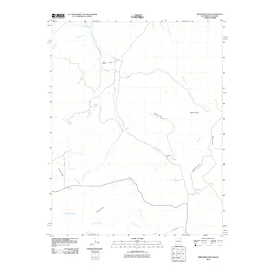
2010 Map of Trinchera Pass
USGS Topo · Published 2010About this map
Pacheco Cemetery sits at the northern edge of this high-country landscape, where the border between Colorado and New Mexico is marked by the Border Ditch. The terrain is characterized by a series of high mesas and deep drainages, with Kelleher Mesa and Chavez Mesa rising above a network of seasonal watercourses. Small ranching settlements and identified points like Doherty, Brannon, Ortiz, and Morrow are connected by a system of rural routes, including Quarter Horse Rd and County Road A-34.
Find a feature on this map
27 named features on this map. Tap any name to fly to it.
Don’t see what you’re looking for? This feature index may not catch every label — zoom into the map to look around manually.
Map Details
Editions of this 2010 Trinchera Pass Map
This is the sole edition of this map. No revisions or reprints were ever made.
Other maps of this area

1891 · Mesa De Maya
USGS Topo · 1:125,000

1892 · Elmoro
USGS Topo · 1:125,000

1893 · Elmoro
USGS Topo · 1:125,000

1893 · Mesa de Maya
USGS Topo · 1:125,000

1897 · Elmoro
USGS Topo · 1:125,000

1954 · Raton
USGS Topo · 1:250,000

1954 · Trinidad
USGS Topo · 1:250,000

1954 · Dalhart
USGS Topo · 1:250,000

1955 · La Junta
USGS Topo · 1:250,000

1955 · Trinidad
USGS Topo · 1:250,000