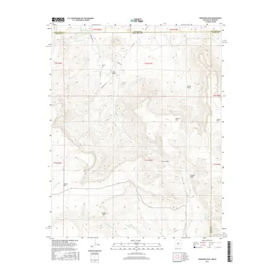
2017 Map of Trinchera Pass
USGS Topo · Published 2017About this map
Trinchera Pass serves as a central landmark in this high-altitude landscape along the border of Colorado and New Mexico. The terrain is defined by significant flat-topped elevations including Johnson Mesa, Kelleher Mesa, and Chavez Mesa, which rise above a network of drainages such as Trinchera Cr and Wild Horse Arroyo. In the northern section, the Pacheco Cem remains a localized historical marker near Bear Canyon, while the southern reaches of the map follow the course of the Dry Cimarron River. The convergence of Las Animas, Colfax, and Union counties highlights the complex jurisdictional boundaries of this region. Local transportation relies on established routes like Trinchera Pass Rd and Doherty Rd, which navigate the mesas and canyons that characterize this western ranching and wilderness area.
Find a feature on this map
37 named features on this map. Tap any name to fly to it.
Don’t see what you’re looking for? This feature index may not catch every label — zoom into the map to look around manually.
Map Details
Editions of this 2017 Trinchera Pass Map
This is the sole edition of this map. No revisions or reprints were ever made.
Other maps of this area

1891 · Mesa De Maya
USGS Topo · 1:125,000

1892 · Elmoro
USGS Topo · 1:125,000

1893 · Elmoro
USGS Topo · 1:125,000

1893 · Mesa de Maya
USGS Topo · 1:125,000

1897 · Elmoro
USGS Topo · 1:125,000

1954 · Raton
USGS Topo · 1:250,000

1954 · Trinidad
USGS Topo · 1:250,000

1954 · Dalhart
USGS Topo · 1:250,000

1955 · La Junta
USGS Topo · 1:250,000

1955 · Trinidad
USGS Topo · 1:250,000