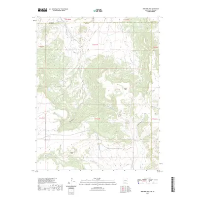
2023 Map of Trinchera Pass
USGS Topo · Published 2023About this map
The high tablelands of Colfax County meet the Colorado state line at Trinchera Pass, a landscape defined by significant elevation changes and seasonal watercourses. The local terrain is dominated by prominent landforms such as Kelleher Mesa and Chavez Mesa, which overlook complex drainage systems including Salazar Arroyo and the headwaters of the Dry Cimarron River. This 2023 survey illustrates a sparsely populated ranching and agricultural region where human presence is marked primarily by scattered family landmarks and historical points of interest. Notable among these is the Pacheco Cem, located near Doherty Rd, serving as a vital touchstone for genealogical research in this borderland area. The map also detailes the convergence of various arroyos and creeks, such as Wild Horse Arroyo and Fisher Creek, which carve through the mesas to form deep features like Creighton Canyon.
Find a feature on this map
37 named features on this map. Tap any name to fly to it.
Don’t see what you’re looking for? This feature index may not catch every label — zoom into the map to look around manually.
Map Details
Editions of this 2023 Trinchera Pass Map
This is the sole edition of this map. No revisions or reprints were ever made.
Other maps of this area

1891 · Mesa De Maya
USGS Topo · 1:125,000

1892 · Elmoro
USGS Topo · 1:125,000

1893 · Elmoro
USGS Topo · 1:125,000

1893 · Mesa de Maya
USGS Topo · 1:125,000

1897 · Elmoro
USGS Topo · 1:125,000

1954 · Raton
USGS Topo · 1:250,000

1954 · Trinidad
USGS Topo · 1:250,000

1954 · Dalhart
USGS Topo · 1:250,000

1955 · La Junta
USGS Topo · 1:250,000

1955 · Trinidad
USGS Topo · 1:250,000