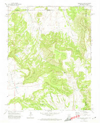
1971 Map of Trinchera Pass
USGS Topo · Published 1974About this map
The high mesa country of the Colorado-New Mexico border stands at the center of this 1971 field-checked survey. Stretching across the county lines of Las Animas and Colfax counties, the landscape is defined by the massive Kelleher Mesa and Chavez Mesa, separated by the strategic crossing at Trinchera Pass. Historical footprints are preserved in the form of the Pacheco Cem and another smaller Cem near the center of the sheet, likely representing early settlement efforts in this arid territory. The drainage system of Trinchera Creek and Arroyo Salazar feeds toward the southern boundary, where the Dry Cimarron River passes near the Folsom State Monument. Numerous cattle-related features like the Border Ditch and various unnamed Jeep Trails suggest a mid-century economy built on ranching and livestock management across this remote interstate borderland.
Find a feature on this map
22 named features on this map. Tap any name to fly to it.
Don’t see what you’re looking for? This feature index may not catch every label — zoom into the map to look around manually.
Map Details
Editions of this 1971 Trinchera Pass Map
This is the sole edition of this map. No revisions or reprints were ever made.
Other maps of this area

1891 · Mesa De Maya
USGS Topo · 1:125,000

1892 · Elmoro
USGS Topo · 1:125,000

1893 · Elmoro
USGS Topo · 1:125,000

1893 · Mesa de Maya
USGS Topo · 1:125,000

1897 · Elmoro
USGS Topo · 1:125,000

1954 · Raton
USGS Topo · 1:250,000

1954 · Trinidad
USGS Topo · 1:250,000

1954 · Dalhart
USGS Topo · 1:250,000

1955 · La Junta
USGS Topo · 1:250,000

1955 · Trinidad
USGS Topo · 1:250,000