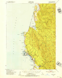
1952 Map of Trinidad
USGS Topo · Published 1954About this map
The coastal redwood forests of northern California meet the Pacific in this 1952 study, centered on the historic fishing village of Trinidad. The landscape is dominated by the industrial operations of the Hammond Lumber Co, whose railroad and haul roads wind through the drainage of the Little River toward the timber town of Crannell. Along the rugged shoreline, a series of state parks and Indian reservations protected significant portions of the coast even in the early 1950s, including Big Lagoon Indian Res and Patricks Point State Park.
Find a feature on this map
68 named features on this map. Tap any name to fly to it.
Don’t see what you’re looking for? This feature index may not catch every label — zoom into the map to look around manually.
Map Details
Editions of this 1952 Trinidad Map
2 editions found
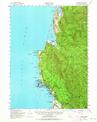
Other maps of this area

1922 · Eureka
USGS Topo · 1:62,500

1922 · Korbel
USGS Topo · 1:62,500

1925 · Hoopa
USGS Topo · 1:125,000

1933 · Eureka
USGS Topo · 1:48,000

1942 · Eureka
USGS Topo · 1:62,500

1945 · Orick
USGS Topo · 1:62,500

1945 · Trinidad
USGS Topo · 1:62,500

1945 · Coyote Peak
USGS Topo · 1:62,500

1945 · Tectah Creek
USGS Topo · 1:62,500

1945 · Blue Lake
USGS Topo · 1:62,500