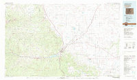
1982 Map of Trinidad
USGS Topo · Published 1983About this map
Trinidad sits at the heart of this Southern Colorado landscape, where the Purgatoire River cuts through the Picketwire Valley beneath the prominent Fisher Peak Mesa. This 1982 survey details a region shaped by high-plains ranching and a legacy of mining, illustrated by the network of small settlements like Cokedale, Starkville, and Ludlow. The infrastructure of the West is visible through the convergence of the Atchison Topeka and Santa Fe Railroad and the Colorado and Southern Railroad near the New Mexico border.
Find a feature on this map
85 named features on this map. Tap any name to fly to it.
Don’t see what you’re looking for? This feature index may not catch every label — zoom into the map to look around manually.
Map Details
Editions of this 1982 Trinidad Map
This is the sole edition of this map. No revisions or reprints were ever made.
Other maps of this area

1889 · Huerfano Park
USGS Topo · 1:125,000

1891 · Walsenburg
USGS Topo · 1:125,000

1891 · Spanish Peaks
USGS Topo · 1:125,000

1891 · Timpas
USGS Topo · 1:125,000

1891 · Apishapa
USGS Topo · 1:125,000

1891 · Mesa De Maya
USGS Topo · 1:125,000

1892 · Huerfano Park
USGS Topo · 1:125,000

1892 · Elmoro
USGS Topo · 1:125,000

1893 · Spanish Peaks
USGS Topo · 1:125,000

1893 · Apishapa
USGS Topo · 1:125,000