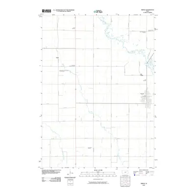
2010 Map of Tripoli
USGS Topo · Published 2010About this map
Tripoli serves as the primary hub of this Bremer County landscape, where the grid of the town site contrasts with the meandering courses of the Wapsipinicon River and Crane Creek. The surrounding rural territory is defined by a dense network of family and township burial grounds, reflecting the deep-rooted agricultural settlement of the region. Distinctive sites such as Old Tripoli and the hamlet of Seigel provide essential points of reference for understanding the evolution of local community centers over time. Significant genealogical resources are scattered throughout the countryside, including the County Farm Cemetery, Alcock Cemetery, and church-affiliated grounds like Saint Pauls Lutheran Cemetery. The presence of the Tripoli Post Office and numerous section roads, such as Killdeer Ave and Piedmont Ave, illustrate the established infrastructure of this Iowa farming heartland in the early 21st century.
Find a feature on this map
34 named features on this map. Tap any name to fly to it.
Don’t see what you’re looking for? This feature index may not catch every label — zoom into the map to look around manually.
Map Details
Editions of this 2010 Tripoli Map
This is the sole edition of this map. No revisions or reprints were ever made.
Other maps of this area

1954 · Waterloo
USGS Topo · 1:250,000

1955 · Waterloo
USGS Topo · 1:250,000

1963 · Waverly
USGS Topo · 1:24,000

1963 · Denver
USGS Topo · 1:24,000

1971 · Readlyn
USGS Topo · 1:24,000

1971 · Bremer
USGS Topo · 1:24,000

1971 · Sumner SW
USGS Topo · 1:24,000

1971 · Tripoli NW
USGS Topo · 1:24,000

1971 · Fredericksburg
USGS Topo · 1:24,000

1971 · Frederika
USGS Topo · 1:24,000