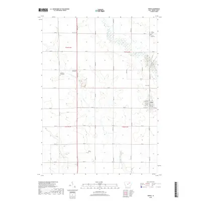
2018 Map of Tripoli
USGS Topo · Published 2018About this map
Tripoli serves as the primary hub in this portion of Bremer County, oriented around a grid of streets including S Main St and 1st Ave SW. The surrounding landscape is defined by the winding course of the Wapsipinicon River and Crane Creek, which carve through a dense network of township roads. This area is particularly notable for its high concentration of rural burial grounds, which offer significant value for genealogical research. These include the Alcock Cem, Saint Pauls Lutheran Cem, and the County Farm Cem. The map illustrates the persistent 19th-century survey grid, where north-south thoroughfares like Larrabee Ave and Midway Ave intersect with east-west section lines. Smaller watercourses like Quarter Section Run further drain the agricultural tracts that lie between these established family and community landmarks.
Find a feature on this map
47 named features on this map. Tap any name to fly to it.
Don’t see what you’re looking for? This feature index may not catch every label — zoom into the map to look around manually.
Map Details
Editions of this 2018 Tripoli Map
This is the sole edition of this map. No revisions or reprints were ever made.
Other maps of this area

1954 · Waterloo
USGS Topo · 1:250,000

1955 · Waterloo
USGS Topo · 1:250,000

1963 · Waverly
USGS Topo · 1:24,000

1963 · Denver
USGS Topo · 1:24,000

1971 · Readlyn
USGS Topo · 1:24,000

1971 · Bremer
USGS Topo · 1:24,000

1971 · Sumner SW
USGS Topo · 1:24,000

1971 · Tripoli NW
USGS Topo · 1:24,000

1971 · Fredericksburg
USGS Topo · 1:24,000

1971 · Frederika
USGS Topo · 1:24,000