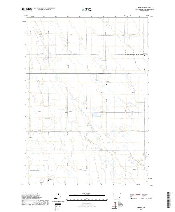
2021 Map of Tripp SE
USGS Topo · Published 2021About this map
The town of Tyndall sits on the southern edge of this modern survey, serving as the primary hub for the surrounding agricultural landscape of Bon Homme County. The terrain is defined by a dense grid of township roads and the meandering paths of several waterways, including Snatch Cr and Beaver Cr, which feed into the central Clear Lake. This area preserves several historical burial sites that reflect the cultural heritage of the early settlers, most notably the Bohemian National Cem in the southwest and the Neuberg Congregational Cem to the north. A notable modern landmark is the Plihal Farms Airport, indicating the continued importance of general aviation and large-scale farming operations in this part of South Dakota. The map's detailed grid, including named routes like 301st St and 417th Ave, illustrates the precise section-line organization typical of the Great Plains.
Find a feature on this map
29 named features on this map. Tap any name to fly to it.
Don’t see what you’re looking for? This feature index may not catch every label — zoom into the map to look around manually.
Map Details
Editions of this 2021 Tripp SE Map
This is the sole edition of this map. No revisions or reprints were ever made.
Other maps of this area

1898 · Olivet
USGS Topo · 1:125,000

1955 · Sioux City
USGS Topo · 1:250,000

1955 · Sioux Falls
USGS Topo · 1:250,000

1957 · Scotland
USGS Topo · 1:24,000

1958 · Sioux City
USGS Topo · 1:250,000

1958 · Sioux Falls
USGS Topo · 1:250,000

1959 · Sioux City
USGS Topo · 1:250,000

1978 · Tripp SE
USGS Topo · 1:24,000
1978 · Kloucek Lake
USGS Topo · 1:24,000
1978 · Tyndall
USGS Topo · 1:24,000
Featured Places
- Washington Township, SD
- Emanuel Township, SD
- Franklin Township, SD
- Jackson Township, SD
- Lincoln Township, SD