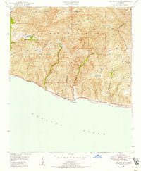
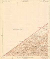
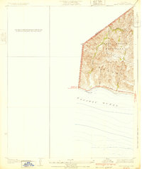
1949 Map of Triunfo Pass
USGS Topo · Published 1958About this map
Santa Monica Mountains topography dominates this coastal landscape, where steep canyons carve toward the Pacific shore. At the edge of the sea, the settlement of Solromar sits along the Roosevelt Highway, serving as a rare point of human habitation in a region defined by its drainage systems like Arroyo Sequit and Big Sycamore Can. Higher in the peaks, infrastructure of the late 1940s is represented by the Yerba Buena Sch and Decker Sch, alongside fire prevention sites like the Triunfo Lookout and Lechuza Fire Patrol Sta. The map highlights the early development of famous thoroughfares, including the winding Mulholland Highway and Yerba Buena Road, which navigated the difficult terrain of Boney Mountain and Triunfo Pass long before the modern expansion of Southern California coastal communities.
Find a feature on this map
36 named features on this map. Tap any name to fly to it.
Don’t see what you’re looking for? This feature index may not catch every label — zoom into the map to look around manually.
Map Details
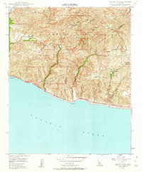
Editions of this 1949 Triunfo Pass Map
3 editions found

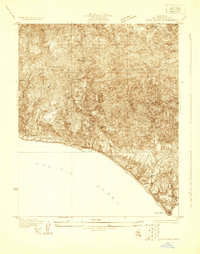
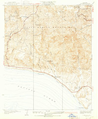
Other maps of this area

1900 · Triunfo Pass
USGS Topo · 1:62,500

1903 · Camulos
USGS Topo · 1:125,000

1904 · Hueneme
USGS Topo · 1:62,500

1921 · Triunfo Pass
USGS Topo · 1:62,500
1929 · Dume Point
USGS Topo · 1:24,000
1932 · Dume Point
USGS Topo · 1:24,000
1932 · Russell Valley
USGS Topo · 1:24,000
1932 · Arroyo Sequit
USGS Topo · 1:24,000

1942 · Hueneme
USGS Topo · 1:62,500

1943 · Hueneme
USGS Topo · 1:62,500
Featured Places
- Malibu, CA
- South Beach, CA
- Unincorporated Santa Monica Mountains, CA
- Ventura County, CA
- Los Angeles County, CA