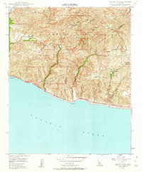
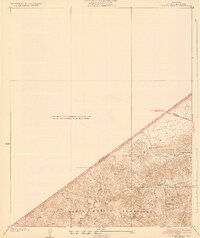
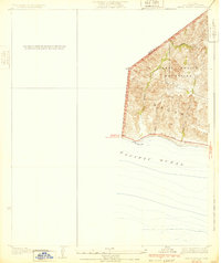
1949 Map of Triunfo Pass
USGS Topo · Published 1962About this map
The Santa Monica Mountains meet the coast in this 1940s topography, revealing a rugged stretch of Ventura and Los Angeles Counties before extensive modern development. The Roosevelt Highway tracks the shoreline at the base of steep canyons, including Big Sycamore Can and Nicholas Canyon, while the inland heights are accessible via the Mulholland Highway. Small outposts like Solromar and localized landmarks such as the Yerba Buena Sch and Decker Sch provide a glimpse into the rural character of the region during this period.
Find a feature on this map
34 named features on this map. Tap any name to fly to it.
Don’t see what you’re looking for? This feature index may not catch every label — zoom into the map to look around manually.
Map Details
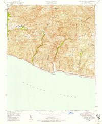
Editions of this 1949 Triunfo Pass Map
3 editions found

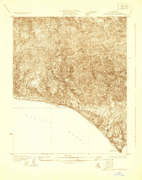
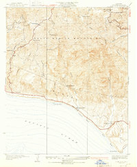
Other maps of this area

1900 · Triunfo Pass
USGS Topo · 1:62,500

1903 · Camulos
USGS Topo · 1:125,000

1904 · Hueneme
USGS Topo · 1:62,500

1921 · Triunfo Pass
USGS Topo · 1:62,500
1929 · Dume Point
USGS Topo · 1:24,000
1932 · Dume Point
USGS Topo · 1:24,000
1932 · Russell Valley
USGS Topo · 1:24,000
1932 · Arroyo Sequit
USGS Topo · 1:24,000

1942 · Hueneme
USGS Topo · 1:62,500

1943 · Hueneme
USGS Topo · 1:62,500
Featured Places
- Malibu, CA
- South Beach, CA
- Unincorporated Santa Monica Mountains, CA
- Ventura County, CA
- Los Angeles County, CA