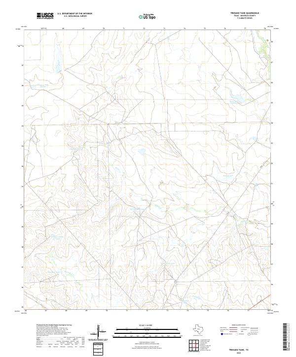
2022 Map of Trosado Tank
USGS Topo · Published 2022About this map
Water management dominates this arid stretch of Maverick County, where a complex network of tanks and creeks defines the land use and ranching history. Distinctive man-made reservoirs like Trosado Tank, Coyote Tank, and Pescado Tank are distributed across the landscape to capture seasonal runoff, a necessity for sustaining life and livestock in this South Texas environment. The presence of these named water sources suggests a long history of range management and perhaps ancestral homesteads nearby.
Find a feature on this map
15 named features on this map. Tap any name to fly to it.
Don’t see what you’re looking for? This feature index may not catch every label — zoom into the map to look around manually.
Map Details
Editions of this 2022 Trosado Tank Map
This is the sole edition of this map. No revisions or reprints were ever made.
Other maps of this area

1896 · Brackett
USGS Topo · 1:125,000

1897 · Brackett
USGS Topo · 1:125,000

1940 · Paloma
USGS Topo · 1:62,500

1940 · Chacon Creek
USGS Topo · 1:62,500

1944 · Spofford
USGS Topo · 1:62,500

1949 · Cline
USGS Topo · 1:62,500

1958 · Eagle Pass
USGS Topo · 1:250,000

1958 · Del Rio
USGS Topo · 1:250,000

1964 · Del Rio
USGS Topo · 1:250,000

1965 · Eagle Pass
USGS Topo · 1:250,000