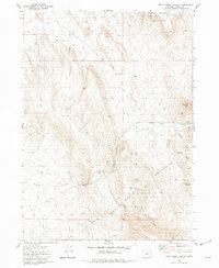
1981 Map of Trout Creek Canyon
USGS Topo · Published 1984About this map
Trout Creek Mountains dominate this high-desert landscape in Harney County, Oregon, during a period defined by ranching and remote land management. The presence of the Adrian Place and a simple Corral suggest the region's historical reliance on livestock and seasonal grazing. Water management is critical in this arid environment, evidenced by the Chalk Canyon Reservoir, a series of named springs including L C Spring and Spring (Hot), and an early Aqueduct. Several Prospects are noted in the vicinity of Chalk Canyon, indicating historical mineral exploration. This 1981 survey also documents essential infrastructure for a remote watershed, such as the Gaging Station on Trout Creek and multiple water tanks used to support both range animals and local operations.
Find a feature on this map
22 named features on this map. Tap any name to fly to it.
Don’t see what you’re looking for? This feature index may not catch every label — zoom into the map to look around manually.
Map Details
Editions of this 1981 Trout Creek Canyon Map
This is the sole edition of this map. No revisions or reprints were ever made.
Other maps of this area

1955 · Adel
USGS Topo · 1:250,000

1957 · Adel
USGS Topo · 1:250,000

1958 · Adel
USGS Topo · 1:250,000

1962 · Adel
USGS Topo · 1:250,000

1971 · Borax Lake
USGS Topo · 1:24,000
1980 · Windy Point
USGS Topo · 1:24,000
1981 · Colony Ranch
USGS Topo · 1:24,000
1981 · Tumtum Lake
USGS Topo · 1:24,000
1981 · Red Mountain
USGS Topo · 1:24,000
1981 · Red Lookout Butte
USGS Topo · 1:24,000