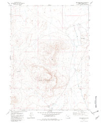
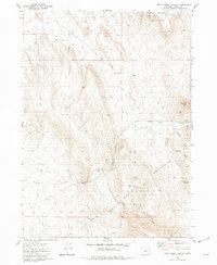
1981 Map of Red Mountain
USGS Topo · Published 1982About this map
Red Mountain dominates this high-desert landscape in Harney County, serving as a prominent topographic anchor for a region defined by its sparse water sources and ranching infrastructure. The map illustrates a reliance on critical water points such as Buckskin Reservoir No 4 and a series of geothermal and seasonal flows, including Hot Spring, Warm Spring, and the appropriately named Twin Springs.
Find a feature on this map
15 named features on this map. Tap any name to fly to it.
Don’t see what you’re looking for? This feature index may not catch every label — zoom into the map to look around manually.
Map Details
Editions of this 1981 Red Mountain Map
This is the sole edition of this map. No revisions or reprints were ever made.
Other maps of this area

1955 · Adel
USGS Topo · 1:250,000

1957 · Adel
USGS Topo · 1:250,000

1958 · Adel
USGS Topo · 1:250,000

1962 · Adel
USGS Topo · 1:250,000

1981 · Tule Springs
USGS Topo · 1:24,000

1981 · Tule Springs NE
USGS Topo · 1:24,000
1981 · Little Whitehorse Creek
USGS Topo · 1:24,000
1981 · Coyote Meadows
USGS Topo · 1:24,000
1981 · Red Lookout Butte
USGS Topo · 1:24,000
1981 · Trout Creek Canyon
USGS Topo · 1:24,000