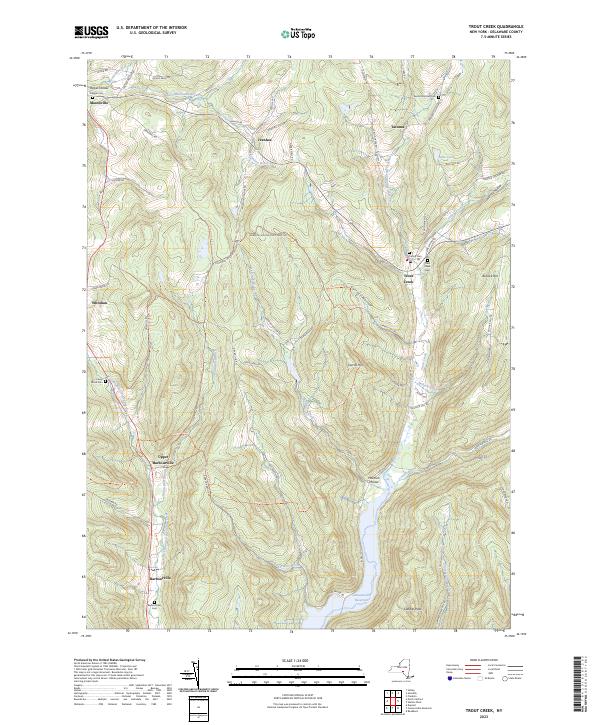
2023 Map of Trout Creek
USGS Topo · Published 2023About this map
Masonville and Trout Creek anchor this Delaware County landscape, where deep-cut valleys and high ridges dictate the local road network. The southern portion of the map is dominated by the northern reaches of the Cannonsville Reservoir, which flooded the lower valleys of Loomis Brook and Barbour Brook. This terrain is dotted with small family and community burial grounds, including the Austin Olmsted Cem near Tacoma and the Pioneer Cem in the northwest. Significant public lands are preserved at the Mormon Hollow State Land Spr, situated between the elevations of Carroll Hill and Bullock Hill. The map traces the historical connections between small crossroads like Ivanhoe and Whitman, following the winding paths of Ivanhoe Brook and Sherruck Brook through the central hollows.
Find a feature on this map
76 named features on this map. Tap any name to fly to it.
Don’t see what you’re looking for? This feature index may not catch every label — zoom into the map to look around manually.
Map Details
Editions of this 2023 Trout Creek Map
This is the sole edition of this map. No revisions or reprints were ever made.
Other maps of this area

1915 · Oneonta
USGS Topo · 1:62,500

1915 · Unadilla
USGS Topo · 1:62,500

1918 · Unadilla
USGS Topo · 1:62,500

1918 · Oneonta
USGS Topo · 1:62,500

1923 · Walton
USGS Topo · 1:48,000

1924 · Deposit
USGS Topo · 1:62,500

1925 · Walton
USGS Topo · 1:62,500

1926 · Deposit
USGS Topo · 1:62,500

1943 · Sidney
USGS Topo · 1:24,000

1943 · Franklin
USGS Topo · 1:24,000