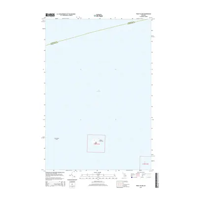
2014 Map of Trout Island
USGS Topo · Published 2014About this map
Trout Island is the focal point of this coastal survey, appearing as a solitary landmass within the larger Beaver Archipelago. Located in the northern reaches of Lake Michigan, the island's isolation is underscored by the expansive surrounding waters and the nearby Trout Island Shoal, which hints at the underwater topography of this island chain. The map also delineates the maritime boundary between Mackinac Co and Charlevoix Co, tracing the administrative division across the open lake. This 2014 edition reflects the modern cartography of these outlying islands, primarily showing the natural terrain and shoreline of the archipelago at the start of the 21st century.
Find a feature on this map
7 named features on this map. Tap any name to fly to it.
Don’t see what you’re looking for? This feature index may not catch every label — zoom into the map to look around manually.
Map Details
Editions of this 2014 Trout Island Map
This is the sole edition of this map. No revisions or reprints were ever made.
Other maps of this area

1931 · Seul Choix Point NE
USGS Topo · 1:31,680

1955 · Gull Island
USGS Topo · 1:62,500

1955 · Cheboygan
USGS Topo · 1:250,000

1956 · Beaver Island
USGS Topo · 1:62,500

1958 · Cheboygan
USGS Topo · 1:250,000
1972 · Hughes Point
USGS Topo · 1:24,000
1973 · Point Patterson
USGS Topo · 1:24,000
1980 · Garden Island West
USGS Topo · 1:24,000

1984 · Beaver Island
USGS Topo · 1:100,000

1986 · High Island
USGS Topo · 1:24,000