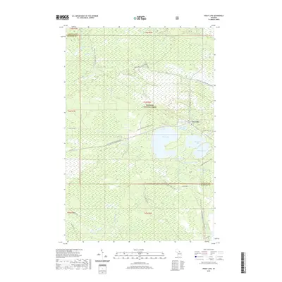
2019 Map of Trout Lake
USGS Topo · Published 2019About this map
Trout Lake serves as the central hub of this Upper Peninsula landscape, where a cluster of freshwater bodies defines the local geography. To the east of the primary lake, Frenchman Lake and Wegwaas Lake sit near the edge of the Hiawatha National Forest, which covers a significant portion of the surrounding township. The settlement area includes the Lakeview Cem, situated near the junction of Trout Lake Rd.
Find a feature on this map
33 named features on this map. Tap any name to fly to it.
Don’t see what you’re looking for? This feature index may not catch every label — zoom into the map to look around manually.
Map Details
Editions of this 2019 Trout Lake Map
This is the sole edition of this map. No revisions or reprints were ever made.
Other maps of this area

1931 · Epoufette SE
USGS Topo · 1:31,680

1931 · Epoufette NE
USGS Topo · 1:31,680

1931 · Epoufette NW
USGS Topo · 1:31,680

1931 · Epoufette SW
USGS Topo · 1:31,680

1941 · Strongs
USGS Topo · 1:63,360

1951 · Strongs
USGS Topo · 1:24,000

1951 · Hulbert
USGS Topo · 1:24,000

1951 · Eckerman
USGS Topo · 1:24,000

1951 · Strongs
USGS Topo · 1:62,500

1951 · Eckerman
USGS Topo · 1:62,500