
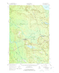
1951 Map of Eckerman
USGS Topo · Published 1958About this map
The Duluth South Shore and Atlantic Railroad cuts a straight path through the heart of the Upper Peninsula, connecting the lumber and sporting camps of the eastern hardwood forests. Centered on the junction at Hulbert, the landscape is defined by the expansive wetlands of the Tahquamenon River and its numerous branches, including the West Branch and South Branch Hendrie River. The presence of several private clubs and lodges, such as the Maple Ridge Club and No Doe Hunting Club, signifies the area's mid-century transition into a premier hunting and fishing destination. To the north, the Tahquamenon Bay shoreline reveals the early infrastructure of the Hiawatha National Forest, while the Eckerman Lookout Tower and a local Fish Hatchery mark the state's active management of these wild lands.
Find a feature on this map
45 named features on this map. Tap any name to fly to it.
Don’t see what you’re looking for? This feature index may not catch every label — zoom into the map to look around manually.
Map Details
Editions of this 1951 Eckerman Map
2 editions found
Other maps of this area

1931 · Epoufette NE
USGS Topo · 1:31,680

1931 · Epoufette NW
USGS Topo · 1:31,680

1931 · Gilchrist NE
USGS Topo · 1:31,680

1941 · Strongs
USGS Topo · 1:63,360

1951 · Strongs
USGS Topo · 1:24,000

1951 · McNearney Lake
USGS Topo · 1:24,000

1951 · Emerson
USGS Topo · 1:24,000

1951 · Piatt Lake
USGS Topo · 1:24,000

1951 · Big Beaver Creek
USGS Topo · 1:24,000

1951 · Hulbert
USGS Topo · 1:24,000