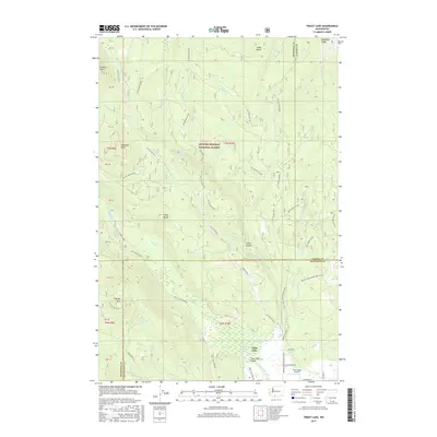
2017 Map of Trout Lake
USGS Topo · Published 2017About this map
The Trout Lake Valley serves as a transition between the high timberlands of the Gifford Pinchot National Forest and the agricultural pocket surrounding the community of Trout Lake. Located at the base of several prominent volcanic features, the area is defined by the White Salmon River and its numerous tributaries, including Trout Lake Creek and Green Canyon Cr. The map reveals a landscape heavily shaped by forestry and recreation, with an extensive network of forest development roads such as Nat For Dev Rd 23 and Nat For Dev Rd 80 providing access to peaks like Haystack Butte and Flattop Mtn. Local infrastructure is concentrated in the valley, where the Trout Lake Airport and Mount Adams Recreation Hwy support the region's connection to the larger Cascade Range.
Find a feature on this map
60 named features on this map. Tap any name to fly to it.
Don’t see what you’re looking for? This feature index may not catch every label — zoom into the map to look around manually.
Map Details
Editions of this 2017 Trout Lake Map
This is the sole edition of this map. No revisions or reprints were ever made.
Other maps of this area

1904 · Mount Adams
USGS Topo · 1:125,000

1907 · Mount Adams
USGS Topo · 1:125,000

1926 · Steamboat Mtn
USGS Topo · 1:125,000

1926 · Hood River
USGS Topo · 1:125,000

1929 · Hood River
USGS Topo · 1:125,000

1931 · Steamboat Mtn
USGS Topo · 1:125,000

1934 · The Dalles
USGS Topo · 1:125,000

1950 · Yakima
USGS Topo · 1:250,000

1953 · The Dalles
USGS Topo · 1:250,000

1956 · The Dalles
USGS Topo · 1:250,000