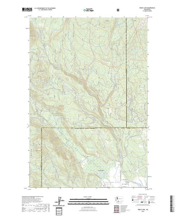
2023 Map of Trout Lake
USGS Topo · Published 2023About this map
The White Salmon Wild and Scenic River carves through a landscape of volcanic buttes and alpine drainages in this modern survey. The settlement of Trout Lake anchors the Trout Lake Valley at the southern edge, serving as a gateway to the Mount Adams Wilderness and the Gifford Pinchot National Forest. This region is defined by a dense network of forest roads and trails, such as the Morrison Creek Trl and Wicky Shelter Trl, which navigate the slopes between Haystack Butte and McDonald Ridge. The presence of the Trout Lake Airport and several local routes like Bear Spring Rd and N Sunnyside Rd highlights the integration of this mountain community with the surrounding protected lands. Notable natural features including Green Canyon and the marshy margins of Trout Lake showcase the diverse hydrology of the Klickitat County highlands.
Find a feature on this map
52 named features on this map. Tap any name to fly to it.
Don’t see what you’re looking for? This feature index may not catch every label — zoom into the map to look around manually.
Map Details
Editions of this 2023 Trout Lake Map
This is the sole edition of this map. No revisions or reprints were ever made.
Other maps of this area

1904 · Mount Adams
USGS Topo · 1:125,000

1907 · Mount Adams
USGS Topo · 1:125,000

1926 · Steamboat Mtn
USGS Topo · 1:125,000

1926 · Hood River
USGS Topo · 1:125,000

1929 · Hood River
USGS Topo · 1:125,000

1931 · Steamboat Mtn
USGS Topo · 1:125,000

1934 · The Dalles
USGS Topo · 1:125,000

1950 · Yakima
USGS Topo · 1:250,000

1953 · The Dalles
USGS Topo · 1:250,000

1956 · The Dalles
USGS Topo · 1:250,000