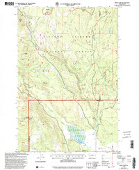
1998 Map of Trout Lake
USGS Topo · Published 2003About this map
The White Salmon River carves through this late 20th-century landscape, serving as a focal point for the mountain drainage systems of the Gifford Pinchot National Forest. This 1998 revision of earlier topographical data highlights the intersection of forestry management and recreational use at the base of the Mt Adams Wilderness. The settlement of Trout Lake is situated near the southern boundary, where the river meets the namesake Trout Lake and a series of agricultural and utility features, including an aqueduct and a local landing strip.
Find a feature on this map
38 named features on this map. Tap any name to fly to it.
Don’t see what you’re looking for? This feature index may not catch every label — zoom into the map to look around manually.
Map Details
Editions of this 1998 Trout Lake Map
This is the sole edition of this map. No revisions or reprints were ever made.
Other maps of this area

1904 · Mount Adams
USGS Topo · 1:125,000

1907 · Mount Adams
USGS Topo · 1:125,000

1926 · Steamboat Mtn
USGS Topo · 1:125,000

1926 · Hood River
USGS Topo · 1:125,000

1929 · Hood River
USGS Topo · 1:125,000

1931 · Steamboat Mtn
USGS Topo · 1:125,000

1934 · The Dalles
USGS Topo · 1:125,000

1950 · Yakima
USGS Topo · 1:250,000

1953 · The Dalles
USGS Topo · 1:250,000

1956 · The Dalles
USGS Topo · 1:250,000