
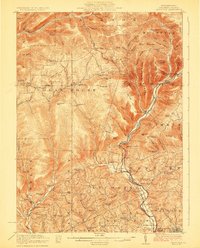
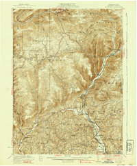
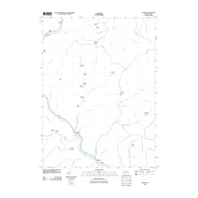
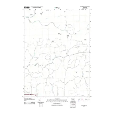
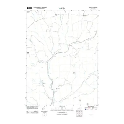
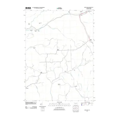
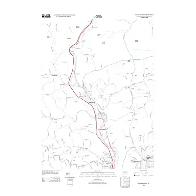
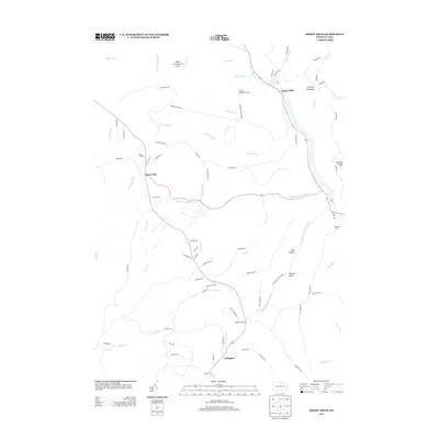
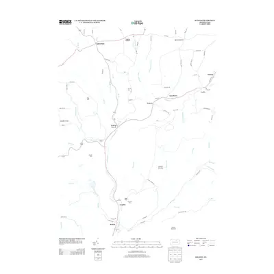
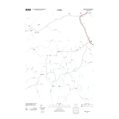
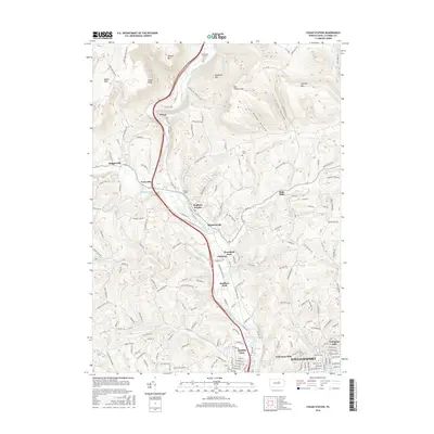
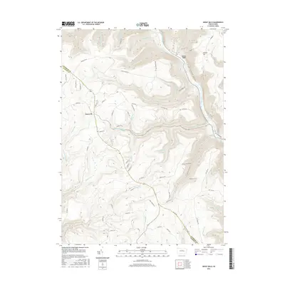
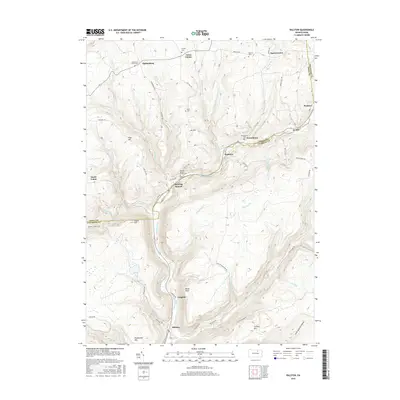
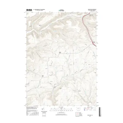
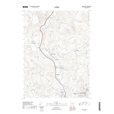
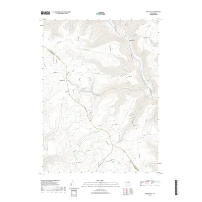
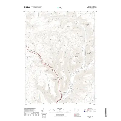
1923 Map of Trout Run
USGS Topo · Published 1945About this map
Lycoming Creek serves as the primary artery for travel and trade in this 1923 survey, with the Pennsylvania RR tracing its narrow valley floor. The geography is defined by a dense network of mountain ridges and deep hollows, including Narrow Mountain and Nail Factory Mtn, which separate the agricultural patches from the timbered heights. This era shows a landscape transitioned from early industry to more settled rural life, marked by a high concentration of one-room schoolhouses like the Steam Mill School, Blacks Creek School, and Falls Factory School. The mapping of small hamlets such as Salladasburg and Balls Mills provides a detailed view of Lycoming County's social geography before mid-century modernization. Distinctive landmarks such as the Lycoming Club near Green Mtn hint at the area's recreational use during the early twentieth century.
Find a feature on this map
107 named features on this map. Tap any name to fly to it.
Don’t see what you’re looking for? This feature index may not catch every label — zoom into the map to look around manually.
Map Details
Editions of this 1923 Trout Run Map
4 editions found

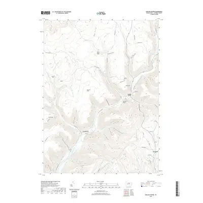
Historical Maps of Williamsport Through Time
116 maps found

1921 Trout Run
Lycoming County, PA
1923 Trout Run
Lycoming County, PA

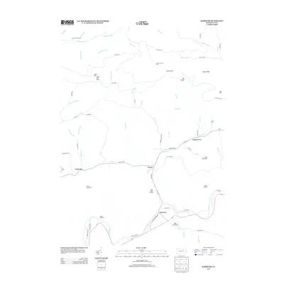
1930 Warrensville
Lycoming County, PA

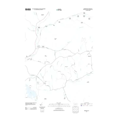
1934 Warrensville
Lycoming County, PA

1935 Waterville
Lycoming County, PA

1937 Waterville
Lycoming County, PA

1943 Waterville
Lycoming County, PA

1944 Trout Run
Lycoming County, PA

1946 Slate Run
Lycoming County, PA

1948 Slate Run
Lycoming County, PA

1953 Warrensville
Lycoming County, PA

1965 Barbours
Lycoming County, PA

1965 Bodines
Lycoming County, PA

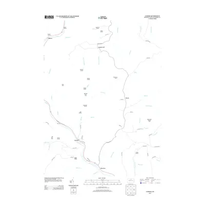
1965 Cammal
Lycoming County, PA

1965 Cogan Station
Lycoming County, PA

1965 English Center
Lycoming County, PA

1965 Huntersville
Lycoming County, PA

1965 Jersey Mills
Lycoming County, PA

1965 Linden
Lycoming County, PA

1965 Montoursville North
Lycoming County, PA

1965 Montoursville South
Lycoming County, PA

1965 Trout Run
Lycoming County, PA

1965 Waterville
Lycoming County, PA

1965 White Pine
Lycoming County, PA

1969 Grover
Lycoming County, PA

1969 Ralston
Lycoming County, PA

1977 Ralston
Lycoming County, PA

1984 Williamsport East
Lycoming County, PA

1994 Cammal
Lycoming County, PA

1994 Cogan Station
Lycoming County, PA

1994 English Center
Lycoming County, PA

1994 Montoursville South
Lycoming County, PA

1994 Slate Run
Lycoming County, PA

1994 Waterville
Lycoming County, PA

1995 Barbours
Lycoming County, PA

1999 Montoursville North
Lycoming County, PA
2010 Barbours
Lycoming County, PA
2010 Bodines
Lycoming County, PA
2010 Cammal
Lycoming County, PA
2010 Cogan Station
Lycoming County, PA
2010 English Center
Lycoming County, PA
2010 Grover
Lycoming County, PA
2010 Huntersville
Lycoming County, PA
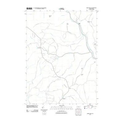
2010 Jersey Mills
Lycoming County, PA

2010 Linden
Lycoming County, PA
2010 Montoursville North
Lycoming County, PA
2010 Montoursville South
Lycoming County, PA
2010 Ralston
Lycoming County, PA
2010 Slate Run
Lycoming County, PA
2010 Trout Run
Lycoming County, PA
2010 Waterville
Lycoming County, PA
2010 White Pine
Lycoming County, PA
2013 Barbours
Lycoming County, PA
2013 Bodines
Lycoming County, PA
2013 Cammal
Lycoming County, PA
2013 Cogan Station
Lycoming County, PA
2013 English Center
Lycoming County, PA
2013 Grover
Lycoming County, PA
2013 Huntersville
Lycoming County, PA
2013 Jersey Mills
Lycoming County, PA
2013 Linden
Lycoming County, PA
2013 Montoursville North
Lycoming County, PA
2013 Montoursville South
Lycoming County, PA
2013 Ralston
Lycoming County, PA
2013 Slate Run
Lycoming County, PA
2013 Trout Run
Lycoming County, PA
2013 Waterville
Lycoming County, PA
2013 White Pine
Lycoming County, PA
2016 Barbours
Lycoming County, PA
2016 Bodines
Lycoming County, PA
2016 Cammal
Lycoming County, PA
2016 Cogan Station
Lycoming County, PA
2016 English Center
Lycoming County, PA
2016 Grover
Lycoming County, PA
2016 Huntersville
Lycoming County, PA
2016 Jersey Mills
Lycoming County, PA
2016 Linden
Lycoming County, PA
2016 Montoursville North
Lycoming County, PA
2016 Montoursville South
Lycoming County, PA
2016 Ralston
Lycoming County, PA
2016 Slate Run
Lycoming County, PA
2016 Trout Run
Lycoming County, PA
2016 Waterville
Lycoming County, PA
2016 White Pine
Lycoming County, PA
2019 Barbours
Lycoming County, PA
2019 Bodines
Lycoming County, PA
2019 Cammal
Lycoming County, PA
2019 Cogan Station
Lycoming County, PA
2019 English Center
Lycoming County, PA
2019 Grover
Lycoming County, PA
2019 Huntersville
Lycoming County, PA
2019 Jersey Mills
Lycoming County, PA

2019 Linden
Lycoming County, PA
2019 Montoursville North
Lycoming County, PA
2019 Montoursville South
Lycoming County, PA
2019 Ralston
Lycoming County, PA
2019 Slate Run
Lycoming County, PA
2019 Trout Run
Lycoming County, PA
2019 Waterville
Lycoming County, PA
2019 White Pine
Lycoming County, PA

2023 Barbours
Lycoming County, PA

2023 Bodines
Lycoming County, PA

2023 Cammal
Lycoming County, PA

2023 Cogan Station
Lycoming County, PA

2023 English Center
Lycoming County, PA

2023 Grover
Lycoming County, PA

2023 Huntersville
Lycoming County, PA

2023 Jersey Mills
Lycoming County, PA

2023 Linden
Lycoming County, PA

2023 Montoursville North
Lycoming County, PA

2023 Montoursville South
Lycoming County, PA

2023 Ralston
Lycoming County, PA

2023 Slate Run
Lycoming County, PA

2023 Trout Run
Lycoming County, PA

2023 Waterville
Lycoming County, PA

2023 White Pine
Lycoming County, PA
Featured Locations
- Williamsport, PA
- Woodward Township, PA
- Salladasburg, PA
- Garden View, Old Lycoming Township
- Steam Valley, Cogan House Township