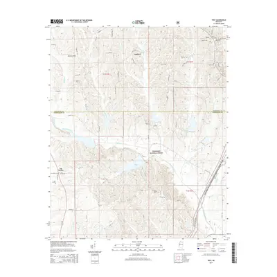
2015 Map of Troy
USGS Topo · Published 2015About this map
Tombigbee National Forest dominates the central landscape of this survey, where the winding waters of Chuquatonchee Creek and the recreational basin of Davis Lake define the terrain. The map follows the historical Natchez Trace Parkway as it cuts through the eastern portion, marking an ancient corridor of travel across northern Mississippi. Small communities like Troy and Goodford are situated along the elevated Pontotoc Ridge, reflecting the region's traditional upland settlement patterns. This area is characterized by its numerous family and community burial grounds, including the Rose Hill Cem near Old Houlka, and the Bluff Springs Cem tucked away in the forest. The drainage network is particularly dense here, with Mill Creek, Little Cr, and Owl Cr carving through the wooded hills and providing a look at the local hydrology before it feeds into the larger river systems to the south.
Find a feature on this map
67 named features on this map. Tap any name to fly to it.
Don’t see what you’re looking for? This feature index may not catch every label — zoom into the map to look around manually.
Map Details
Editions of this 2015 Troy Map
This is the sole edition of this map. No revisions or reprints were ever made.
Other maps of this area

1953 · West Point
USGS Topo · 1:250,000

1956 · Tupelo
USGS Topo · 1:250,000

1958 · Tupelo
USGS Topo · 1:250,000

1958 · West Point
USGS Topo · 1:250,000

1959 · Van Vleet
USGS Topo · 1:62,500

1963 · West Point
USGS Topo · 1:250,000

1966 · Troy NW
USGS Topo · 1:24,000

1966 · Troy SE
USGS Topo · 1:24,000

1966 · Bissell
USGS Topo · 1:24,000

1966 · Troy
USGS Topo · 1:24,000