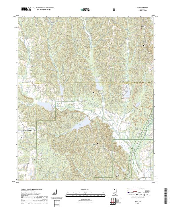
2024 Map of Troy
USGS Topo · Published 2024About this map
Old Houlka and the surrounding woodlands of the Tombigbee National Forest define this portion of the northern Mississippi landscape. The terrain is marked by the prominent Pontotoc Ridge in the northwest, which gives way to a complex network of waterways including Chuquatonchee Creek and Houlka Creek. A significant recreational and geographical anchor is Davis Lake, which sits near the convergence of numerous county roads and forest tracks. Several small rural settlements like Troy and Goodford are mapped alongside family and community landmarks such as Rose Hill Cem and Bluff Springs Cem. The presence of Natchez Trace Parkway cutting through the southeast corner suggests the area's role as a transit corridor, balancing forest management, small-scale agriculture, and historical settlement patterns that follow the creek valleys.
Find a feature on this map
67 named features on this map. Tap any name to fly to it.
Don’t see what you’re looking for? This feature index may not catch every label — zoom into the map to look around manually.
Map Details
Editions of this 2024 Troy Map
This is the sole edition of this map. No revisions or reprints were ever made.
Other maps of this area

1953 · West Point
USGS Topo · 1:250,000

1956 · Tupelo
USGS Topo · 1:250,000

1958 · Tupelo
USGS Topo · 1:250,000

1958 · West Point
USGS Topo · 1:250,000

1959 · Van Vleet
USGS Topo · 1:62,500

1963 · West Point
USGS Topo · 1:250,000

1966 · Troy NW
USGS Topo · 1:24,000

1966 · Troy SE
USGS Topo · 1:24,000

1966 · Bissell
USGS Topo · 1:24,000

1966 · Troy
USGS Topo · 1:24,000