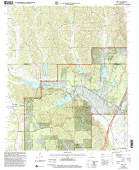
2000 Map of Troy
USGS Topo · Published 2002About this map
Tombigbee National Forest dominates this landscape on the Pontotoc and Chickasaw County border, where the headwaters of Chuquatonchee Creek and Owl Creek carve through the terrain. The presence of the Owl Creek Indian Mounds near the Natzhez Trace Parkway points to a long history of human activity preceding the late-twentieth-century rural settlements.
Find a feature on this map
35 named features on this map. Tap any name to fly to it.
Don’t see what you’re looking for? This feature index may not catch every label — zoom into the map to look around manually.
Map Details
Editions of this 2000 Troy Map
This is the sole edition of this map. No revisions or reprints were ever made.
Other maps of this area

1953 · West Point
USGS Topo · 1:250,000

1956 · Tupelo
USGS Topo · 1:250,000

1958 · Tupelo
USGS Topo · 1:250,000

1958 · West Point
USGS Topo · 1:250,000

1959 · Van Vleet
USGS Topo · 1:62,500

1963 · West Point
USGS Topo · 1:250,000

1966 · Troy NW
USGS Topo · 1:24,000

1966 · Troy SE
USGS Topo · 1:24,000

1966 · Bissell
USGS Topo · 1:24,000

1966 · Troy
USGS Topo · 1:24,000