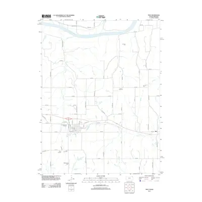
2012 Map of Troy
USGS Topo · Published 2012About this map
The Missouri River defines the northern reaches of this landscape, carving a wide valley floor as it flows east toward the bluffs of Doniphan County. South of the river, a network of agricultural roads and creeks like Mosquito Cr and Peters Cr drain the uplands. The settlement of Blair sits on the eastern edge of the sheet, while the central town area is marked by civic and agricultural hubs including the Doniphan County Fairgrounds. Several family and community burial grounds are scattered across the township, providing a clear record of local settlement patterns through the centuries. Notable sites include Saint Charles Cem and Mount Olive Cem to the south, and Charleston Cem overlooking the river valley. General aviation is represented by Masters Field Airport, situated among the headwaters of Cottonwood Cr and Rock Cr.
Find a feature on this map
56 named features on this map. Tap any name to fly to it.
Don’t see what you’re looking for? This feature index may not catch every label — zoom into the map to look around manually.
Map Details
Editions of this 2012 Troy Map
This is the sole edition of this map. No revisions or reprints were ever made.
Other maps of this area

1885 · Atchison
USGS Topo · 1:125,000

1888 · Atchison
USGS Topo · 1:125,000

1893 · Atchison
USGS Topo · 1:125,000

1924 · St. Joseph
USGS Topo · 1:62,500

1926 · Atchison
USGS Topo · 1:62,500

1926 · Saint Joseph
USGS Topo · 1:62,500

1926 · Oregon
USGS Topo · 1:62,500

1927 · Dearborn
USGS Topo · 1:62,500

1950 · Kansas City
USGS Topo · 1:250,000

1954 · Kansas City
USGS Topo · 1:250,000