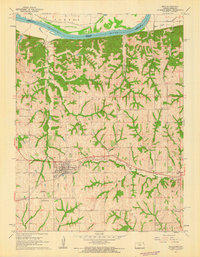
1961 Map of Troy
USGS Topo · Published 1962About this map
The Missouri River forms a major geographical boundary in the north, creating the fertile Burr Oak Bottom at the state line between Kansas and Missouri. This 1961 record illustrates the dense drainage network of the region, where tributaries like Mosquito Creek and Peters Creek carve through the landscape. The seat of Center township, Troy, serves as a critical junction for regional transportation, positioned at the intersection of the Chicago Rock Island and Pacific and the Union Pacific railroads.
Find a feature on this map
34 named features on this map. Tap any name to fly to it.
Don’t see what you’re looking for? This feature index may not catch every label — zoom into the map to look around manually.
Map Details
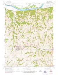
Editions of this 1961 Troy Map
2 editions found
Other maps of this area

1885 · Atchison
USGS Topo · 1:125,000

1888 · Atchison
USGS Topo · 1:125,000

1893 · Atchison
USGS Topo · 1:125,000

1924 · St. Joseph
USGS Topo · 1:62,500

1926 · Atchison
USGS Topo · 1:62,500

1926 · Saint Joseph
USGS Topo · 1:62,500

1926 · Oregon
USGS Topo · 1:62,500

1927 · Dearborn
USGS Topo · 1:62,500

1950 · Kansas City
USGS Topo · 1:250,000

1954 · Kansas City
USGS Topo · 1:250,000