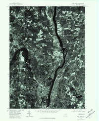
1978 Map of Troy North
USGS Topo · Published 1982About this map
Waterford and Cohoes sit at the strategic confluence of the Hudson River and the Mohawk River, illustrating the dense industrial and residential patterns established in this river corridor by the late 1970s. This orthophotoquad, produced through photoimagery rectified by automatic correlation, provides a unique visual record of the northern reaches of Troy and the surrounding Saratoga County landscape. The contrast between the urbanized riverbanks and the upland agricultural fields of Newton and Melrose is starkly visible. To the east, the Troy Reservoir remains a distinct landmark within the wooded hills. Unlike traditional topographic maps, this aerial perspective captures the exact footprint of development in settlements like Halemoon during a period of transition in New York's Capital Region.
Find a feature on this map
9 named features on this map. Tap any name to fly to it.
Don’t see what you’re looking for? This feature index may not catch every label — zoom into the map to look around manually.
Map Details
Editions of this 1978 Troy North Map
This is the sole edition of this map. No revisions or reprints were ever made.
Other maps of this area

1893 · Cohoes
USGS Topo · 1:62,500

1893 · Troy
USGS Topo · 1:62,500

1893 · Schenectady
USGS Topo · 1:62,500

1893 · Albany
USGS Topo · 1:62,500

1895 · Troy
USGS Topo · 1:62,500

1895 · Cohoes
USGS Topo · 1:62,500

1895 · Albany
USGS Topo · 1:62,500

1895 · Schenectady
USGS Topo · 1:62,500

1898 · Schenectady
USGS Topo · 1:62,500

1898 · Albany
USGS Topo · 1:62,500