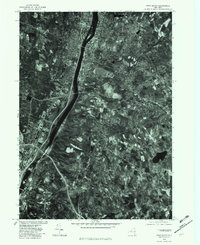
1978 Map of Troy South
USGS Topo · Published 1982About this map
The Hudson River serves as the central artery for this late-1970s orthophotoquad, dividing the industrial and residential landscapes of Watervliet and Troy. This specialized imagery, produced in cooperation with the Soil Conservation Service, reveals the dense urban grid and riverside infrastructure characteristic of this corridor. To the east, the terrain shifts into the suburban and rural patterns of Wynantskill and Defreetsville, where the meandering paths of the Poesten Kill and Wynants Kill cut through the landscape toward the river. Local landmarks like Snyders Lake and the neighborhood of Albia are clearly visible, showing the state of land use and development just as modern interstate networks were becoming well-established in the region.
Find a feature on this map
11 named features on this map. Tap any name to fly to it.
Don’t see what you’re looking for? This feature index may not catch every label — zoom into the map to look around manually.
Map Details
Editions of this 1978 Troy South Map
This is the sole edition of this map. No revisions or reprints were ever made.
Other maps of this area

1893 · Cohoes
USGS Topo · 1:62,500

1893 · Troy
USGS Topo · 1:62,500

1893 · Schenectady
USGS Topo · 1:62,500

1893 · Albany
USGS Topo · 1:62,500

1895 · Troy
USGS Topo · 1:62,500

1895 · Cohoes
USGS Topo · 1:62,500

1895 · Albany
USGS Topo · 1:62,500

1895 · Schenectady
USGS Topo · 1:62,500

1898 · Schenectady
USGS Topo · 1:62,500

1898 · Albany
USGS Topo · 1:62,500