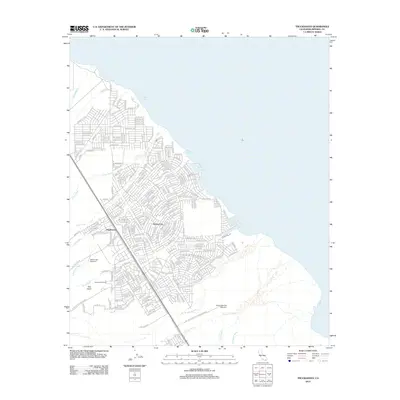
2012 Map of Truckhaven
USGS Topo · Published 2012About this map
Salton City stands at the western edge of the Salton Sea, defined by an extensive grid of residential streets that speak to mid-century development ambitions in the Imperial Valley desert. This 2012 survey illustrates a landscape where planned infrastructure meets the arid reality of the basin, with many thoroughfares like Annapolis Ave and Bering Blvd extending into the surrounding desert. The map captures the specialized land use of the era, including the Salton Sea Test Base B-1 and Salton Sea Base B-2, alongside recreational markers like the Salton Golf Course. Natural drainage features, characterized by numerous desert washes such as Arroyo Salada, Iberia Wash, and Coral Wash, crisscross the area, emphasizing the hydrological challenges of the terrain. The presence of Truckhaven near Anza Ditch further identifies local landmarks significant to the region's geography and history.
Find a feature on this map
239 named features on this map. Tap any name to fly to it.
Don’t see what you’re looking for? This feature index may not catch every label — zoom into the map to look around manually.
Map Details
Editions of this 2012 Truckhaven Map
This is the sole edition of this map. No revisions or reprints were ever made.
Other maps of this area

1904 · Indio
USGS Topo · 1:125,000

1931 · Vallecito
USGS Topo · 1:125,000

1940 · Kane Spring
USGS Topo · 1:62,500

1940 · Durmid
USGS Topo · 1:62,500

1942 · Barrel Spring
USGS Topo · 1:62,500

1942 · Agua Dulce
USGS Topo · 1:62,500

1943 · Vallecito
USGS Topo · 1:125,000

1944 · Agua Dulce
USGS Topo · 1:62,500

1944 · Durmid
USGS Topo · 1:62,500

1944 · Kane Spring
USGS Topo · 1:62,500