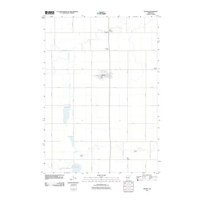
2010 Map of Truman
USGS Topo · Published 2010About this map
Truman serves as the central hub of this agricultural region in southern Minnesota, anchored by the Truman Post Office. The surrounding landscape is defined by a grid of rural routes like County Hwy 40 and 240th St, punctuated by numerous small burial grounds that suggest a long history of family farming and local congregations. Among these are the Antrim-Saint John Cemetery, Ridge Lawn Cemetery, and the uniquely named True Farm Cemetery to the southeast. Natural drainage across the prairie is marked by the winding paths of Perch Creek and Elm Creek, which connect several localized water bodies including Perch Lake and Martin Lake. This survey illustrates the persistent rural character of the area, where the spatial distribution of landmarks like Westford Cemetery and Horicon Cemetery provides a clear view of the township divisions and historical land use patterns established over generations.
Find a feature on this map
35 named features on this map. Tap any name to fly to it.
Don’t see what you’re looking for? This feature index may not catch every label — zoom into the map to look around manually.
Map Details
Editions of this 2010 Truman Map
This is the sole edition of this map. No revisions or reprints were ever made.
Other maps of this area

1954 · Fairmont
USGS Topo · 1:250,000

1958 · Fairmont
USGS Topo · 1:250,000

1967 · Truman
USGS Topo · 1:24,000

1967 · Truman SE
USGS Topo · 1:24,000

1967 · Willow Creek
USGS Topo · 1:24,000

1967 · Lewisville
USGS Topo · 1:24,000

1967 · Granada
USGS Topo · 1:24,000

1967 · Fairmont
USGS Topo · 1:24,000

1970 · St James SE
USGS Topo · 1:24,000
1970 · St James East
USGS Topo · 1:24,000