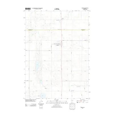
2013 Map of Truman
USGS Topo · Published 2013About this map
Truman sits at the heart of this agricultural landscape, centered at the intersection of W Ciro St and MN-15. The settlement serves as the primary hub for the surrounding township, featuring its own Po and a grid of residential avenues that give way to the expansive fields of the northern prairie. The map reveals a high density of rural burial grounds, including the Antrim-Saint John Cem and Ridge Lawn Cem to the north, and True Farm Cem to the southeast, providing valuable location data for genealogists tracking local families. Hydrological patterns are defined by the winding course of Perch Cr and Elm Cr, which connect several glacial bodies of water like Perch Lake and Martin Lake. This network of creeks and drainage basins illustrates the complex water management required for the intensive farming operations that dominate the Watonwan and Martin county line.
Find a feature on this map
35 named features on this map. Tap any name to fly to it.
Don’t see what you’re looking for? This feature index may not catch every label — zoom into the map to look around manually.
Map Details
Editions of this 2013 Truman Map
This is the sole edition of this map. No revisions or reprints were ever made.
Other maps of this area

1954 · Fairmont
USGS Topo · 1:250,000

1958 · Fairmont
USGS Topo · 1:250,000

1967 · Truman
USGS Topo · 1:24,000

1967 · Truman SE
USGS Topo · 1:24,000

1967 · Willow Creek
USGS Topo · 1:24,000

1967 · Lewisville
USGS Topo · 1:24,000

1967 · Granada
USGS Topo · 1:24,000

1967 · Fairmont
USGS Topo · 1:24,000

1970 · St James SE
USGS Topo · 1:24,000
1970 · St James East
USGS Topo · 1:24,000