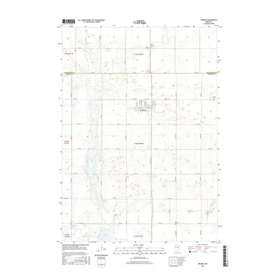
2016 Map of Truman
USGS Topo · Published 2016About this map
Truman serves as the central hub of this agricultural landscape in southern Minnesota, situated along the border of Watonwan and Martin Counties. The town's grid is well-defined by streets such as N Central Ave and E Ciro St, reflecting a classic Midwestern prairie settlement pattern. The surrounding territory is characterized by a high density of rural burial grounds, including the Antrim- Saint John Cem and Ridge Lawn Cem to the north, and the Horicon Cem near the southern boundary, which provide valuable points of interest for genealogical research.
Find a feature on this map
52 named features on this map. Tap any name to fly to it.
Don’t see what you’re looking for? This feature index may not catch every label — zoom into the map to look around manually.
Map Details
Editions of this 2016 Truman Map
This is the sole edition of this map. No revisions or reprints were ever made.
Other maps of this area

1954 · Fairmont
USGS Topo · 1:250,000

1958 · Fairmont
USGS Topo · 1:250,000

1967 · Truman
USGS Topo · 1:24,000

1967 · Truman SE
USGS Topo · 1:24,000

1967 · Willow Creek
USGS Topo · 1:24,000

1967 · Lewisville
USGS Topo · 1:24,000

1967 · Granada
USGS Topo · 1:24,000

1967 · Fairmont
USGS Topo · 1:24,000

1970 · St James SE
USGS Topo · 1:24,000
1970 · St James East
USGS Topo · 1:24,000