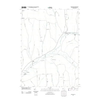
2013 Map of Truxton
USGS Topo · Published 2013About this map
The E Br Tioughnioga River and its valley shape the settlement patterns of this central New York corridor, where the historic hamlet of Truxton serves as a focal point. This 2013 survey illustrates a landscape deeply rooted in agriculture, dotted with active operations like Hilltop Divine Dairy, Heritage Farms, and the Spring Valley Dairy Farm. These modern farmsteads sit alongside reminders of earlier generations, including the Old Presbyterian Church Cem and the Truxton Village Protestant Cem.
Find a feature on this map
80 named features on this map. Tap any name to fly to it.
Don’t see what you’re looking for? This feature index may not catch every label — zoom into the map to look around manually.
Map Details
Editions of this 2013 Truxton Map
This is the sole edition of this map. No revisions or reprints were ever made.
Other maps of this area

1897 · Cazenovia
USGS Topo · 1:62,500

1899 · Cazenovia
USGS Topo · 1:62,500

1900 · Tully
USGS Topo · 1:62,500

1903 · Cortland
USGS Topo · 1:62,500

1904 · Pitcher
USGS Topo · 1:62,500

1943 · Otisco Valley
USGS Topo · 1:31,680
1943 · Tully
USGS Topo · 1:24,000

1943 · De Ruyter
USGS Topo · 1:24,000

1943 · Cincinnatus
USGS Topo · 1:24,000

1943 · Cuyler
USGS Topo · 1:24,000